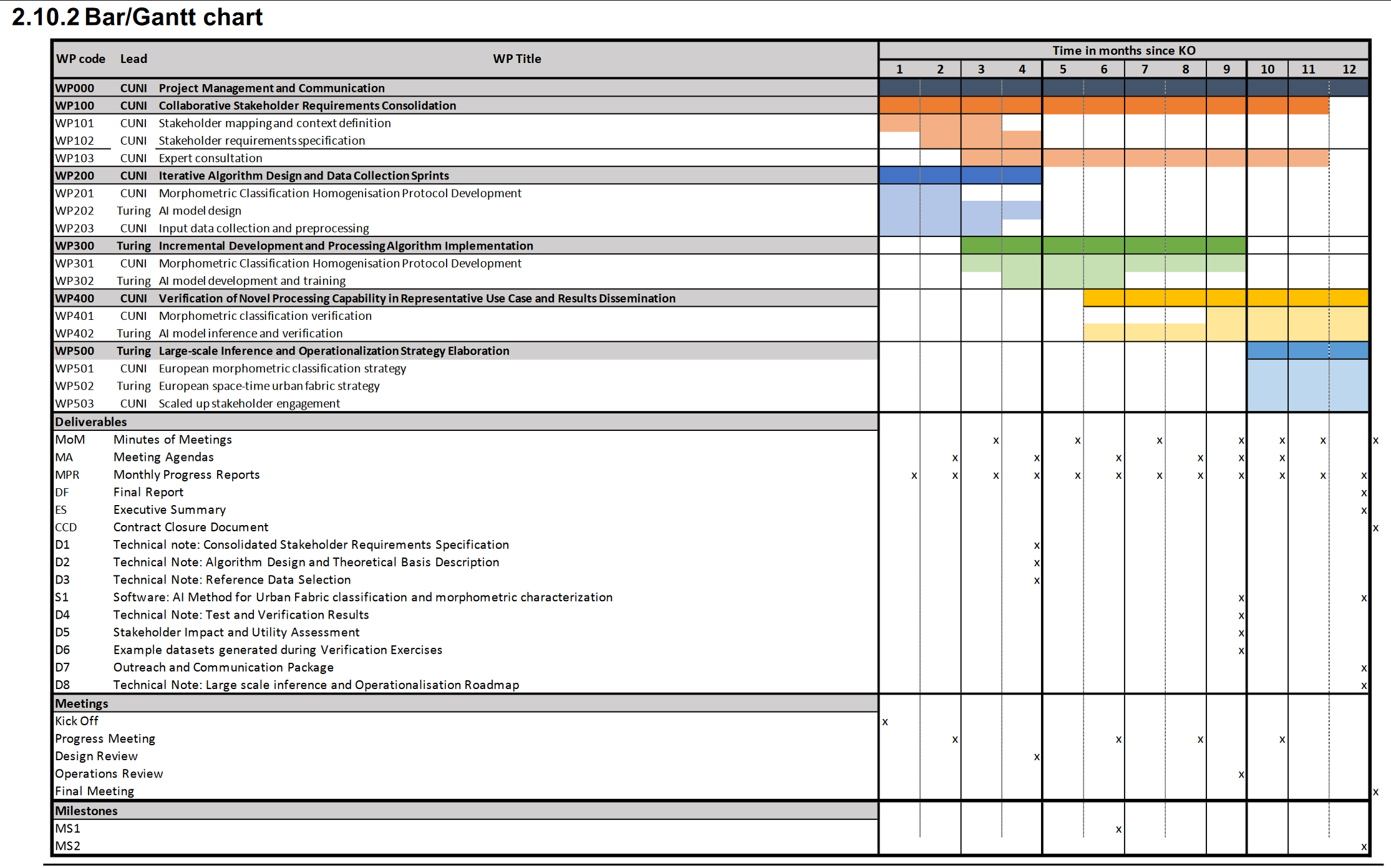
EuroFab Final Review
2025-05-30
Agenda
- Project overview
- Morphometric model
- AI vision model
- Stakeholder engagement
- Future work
- Discussion
structure of human settlements
temporal dimension
Why urban fabric
Cities take up around 3% of the planet’s land but are home to more than half of humanity and responsible for 75% of carbon emissions1.
Why urban fabric
Urban fabric, the spatial layout of the physical elements that make up a city, mediates most activities their residents undertake, from heating their homes to accessing services, jobs and opportunities through sustainable modes of transport.
Why urban fabric
Easily available, comparable, and dynamic information on urban fabric would unlock new ways of understanding how cities are constantly evolving, what it means for their sustainability, and how effective policies can be designed to steer development in desirable directions.
Why now
In 2023, UN Habitat included urban fabric as one of the key ingredients required for effective sustainable design1
Why now
There are currently very few instances of detailed, consistent, and scalable measurements of urban fabric and virtually none of them provide insight into its change over time.
EuroFab vision
EuroFab paves the road for a world where stakeholders, from local authorities to supranational organisations, are able to track and monitor the pattern of urban development in detail directly relevant for planning and at scale.
we’re getting there
Objectives
Technical objectives
- Specify, develop, and validate innovative methods integrating raster (satellite) and vector data in rich and explainable characterisations of urban fabric.
Technical objectives
- Test the comparative performance of transformer-based (foundation) vision models against the baseline of convolution-based neural networks.
Technical objectives
- Evaluate the selected models on two European regions.
Technical objectives
- Develop open-source software, algorithms and open datasets that ensure the sustainability and usability of the project outputs beyond the initial funding period.
Technical objectives
- Create the roadmap for a large-scale inference chain (i.e. covering all of Europe or parts of the globe) for the capability being developed.
Where we are
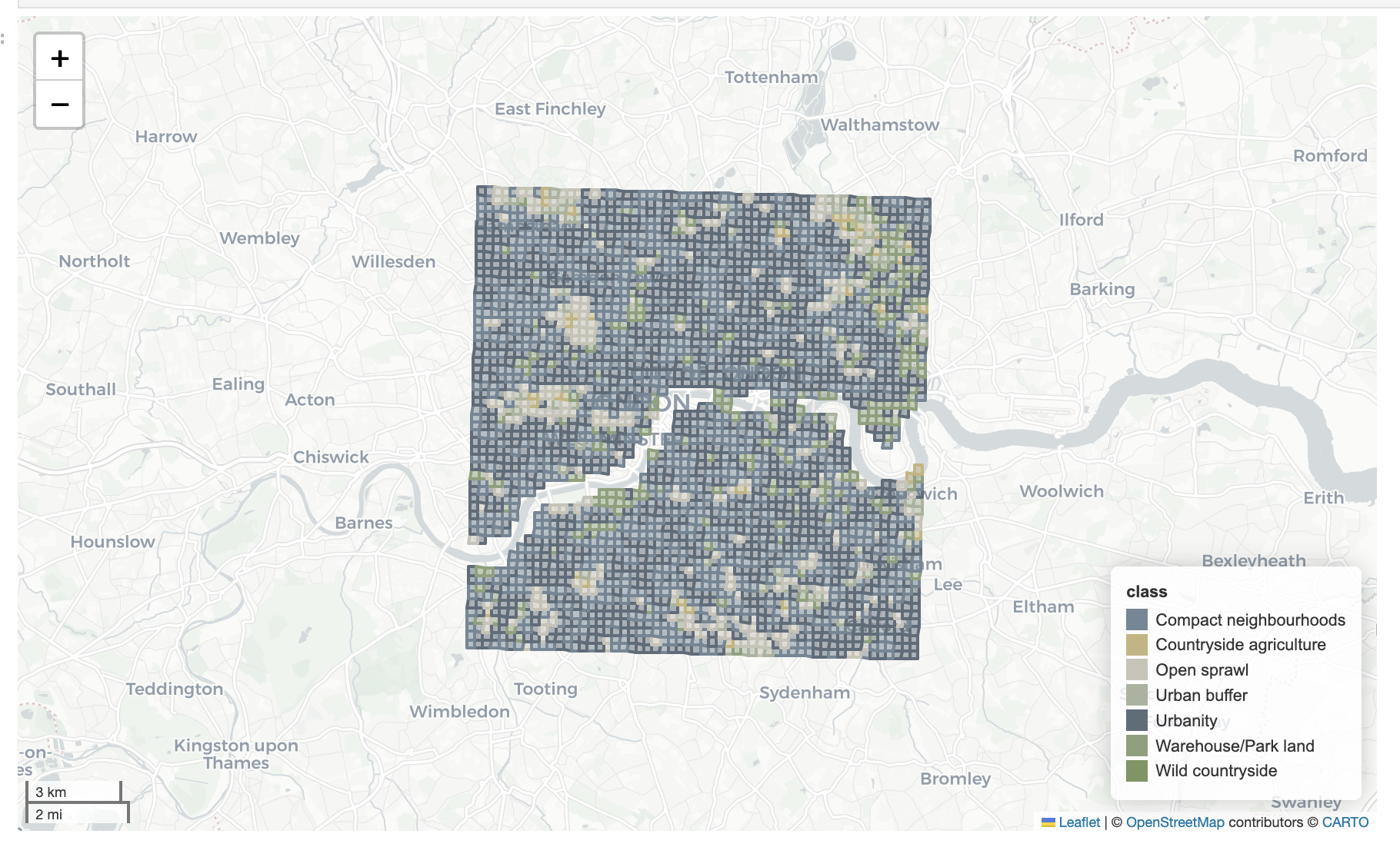
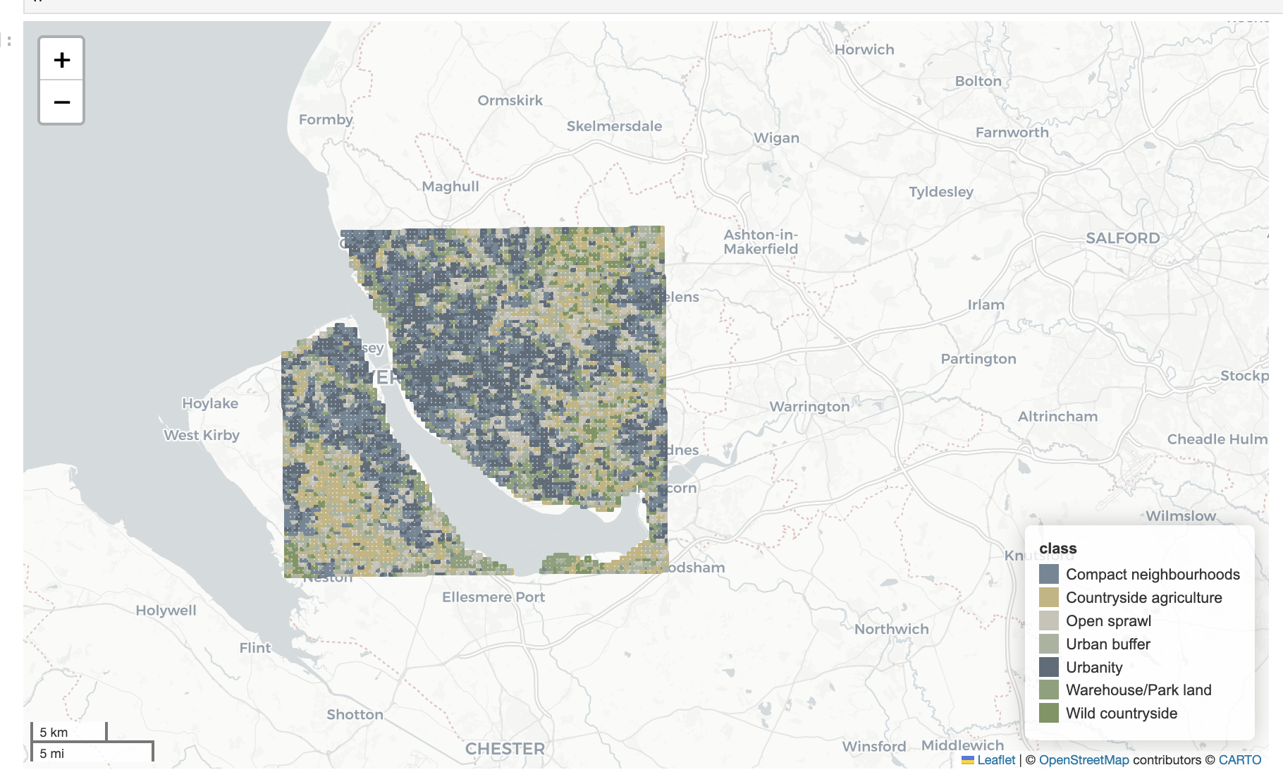
Morphometric model
Morphological elements
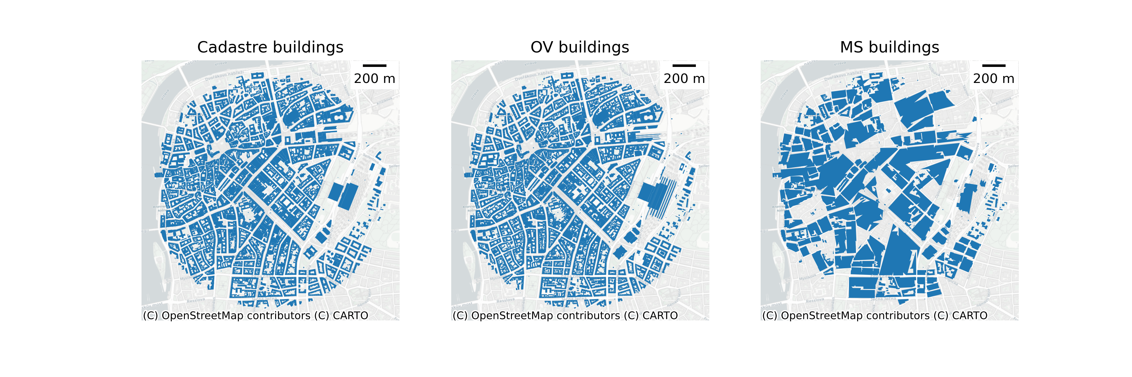
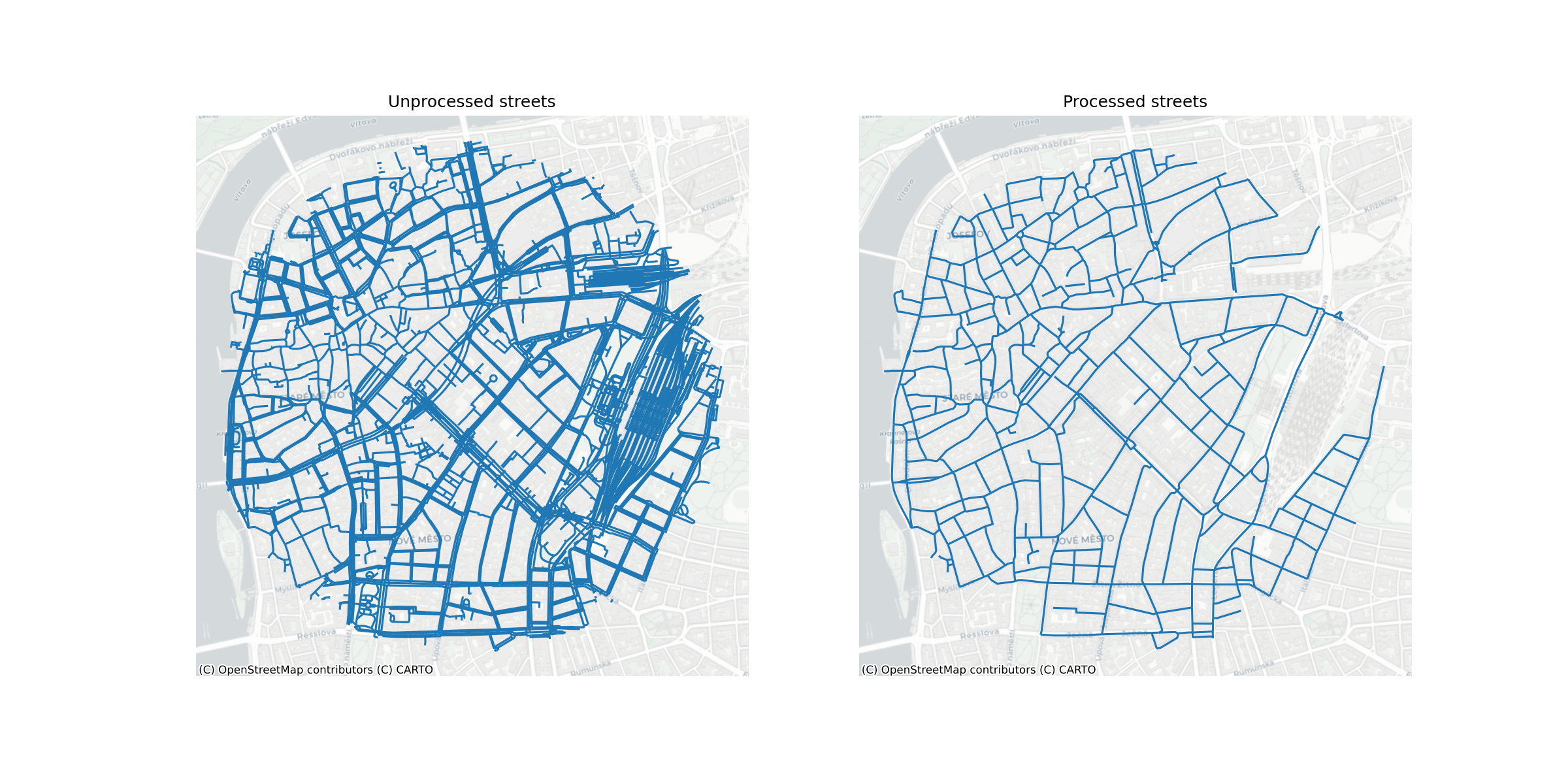
Morphological characters
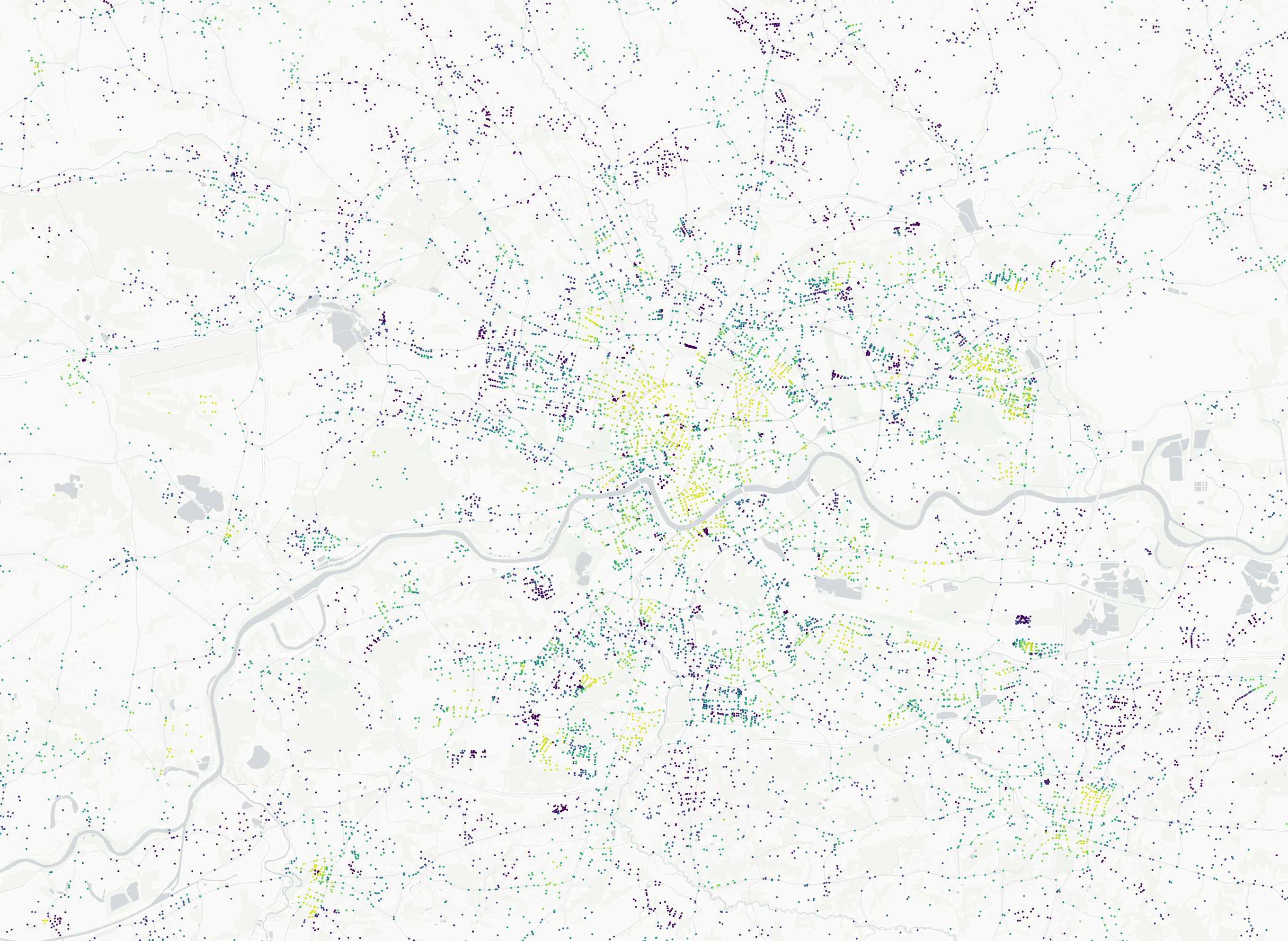
Modeling
Results
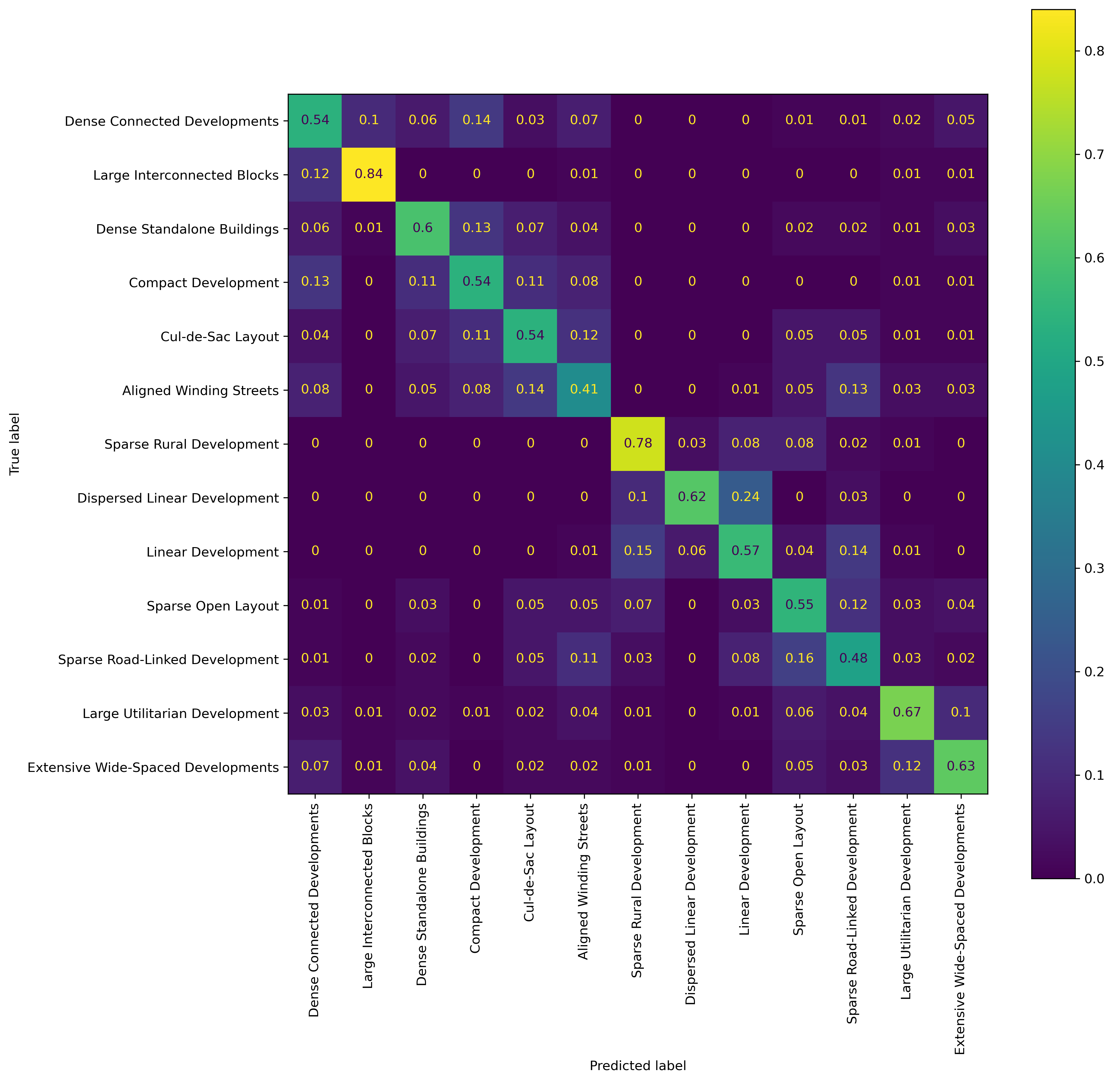
Confusion Matrix
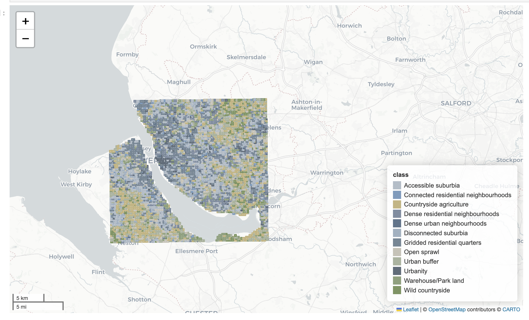
AI vision model
Approach
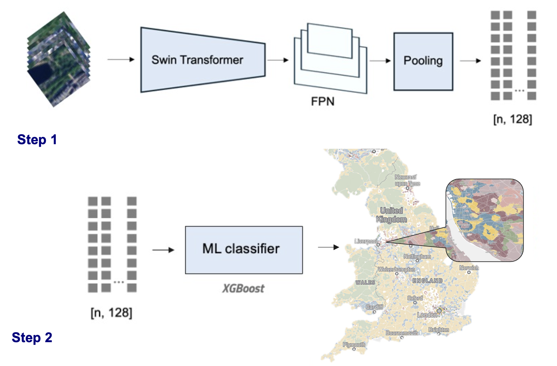
Spatial signatures as ground truth data
- Spatial signatures framework (Arribas-Bel & Fleischmann 2022)
- Proxy due to its conceptual alignment with the morphometric model
Classifier
| Classes (K) | Spatial Context | Accuracy | Macro Accuracy | Macro F1 Score |
|---|---|---|---|---|
| 7 | None | 0.4924 | 0.3856 | 0.3389 |
| 7 | H3 (res 5) | 0.6959 | 0.5713 | 0.5221 |
| 12 | None | 0.4617 | 0.2666 | 0.2127 |
| 12 | H3 (res 5) | 0.6654 | 0.4328 | 0.3654 |
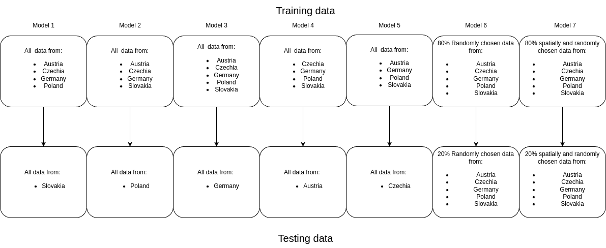
The more training data the better
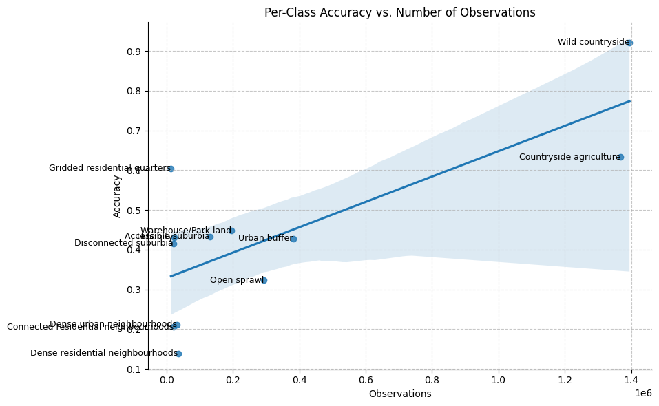
Examples
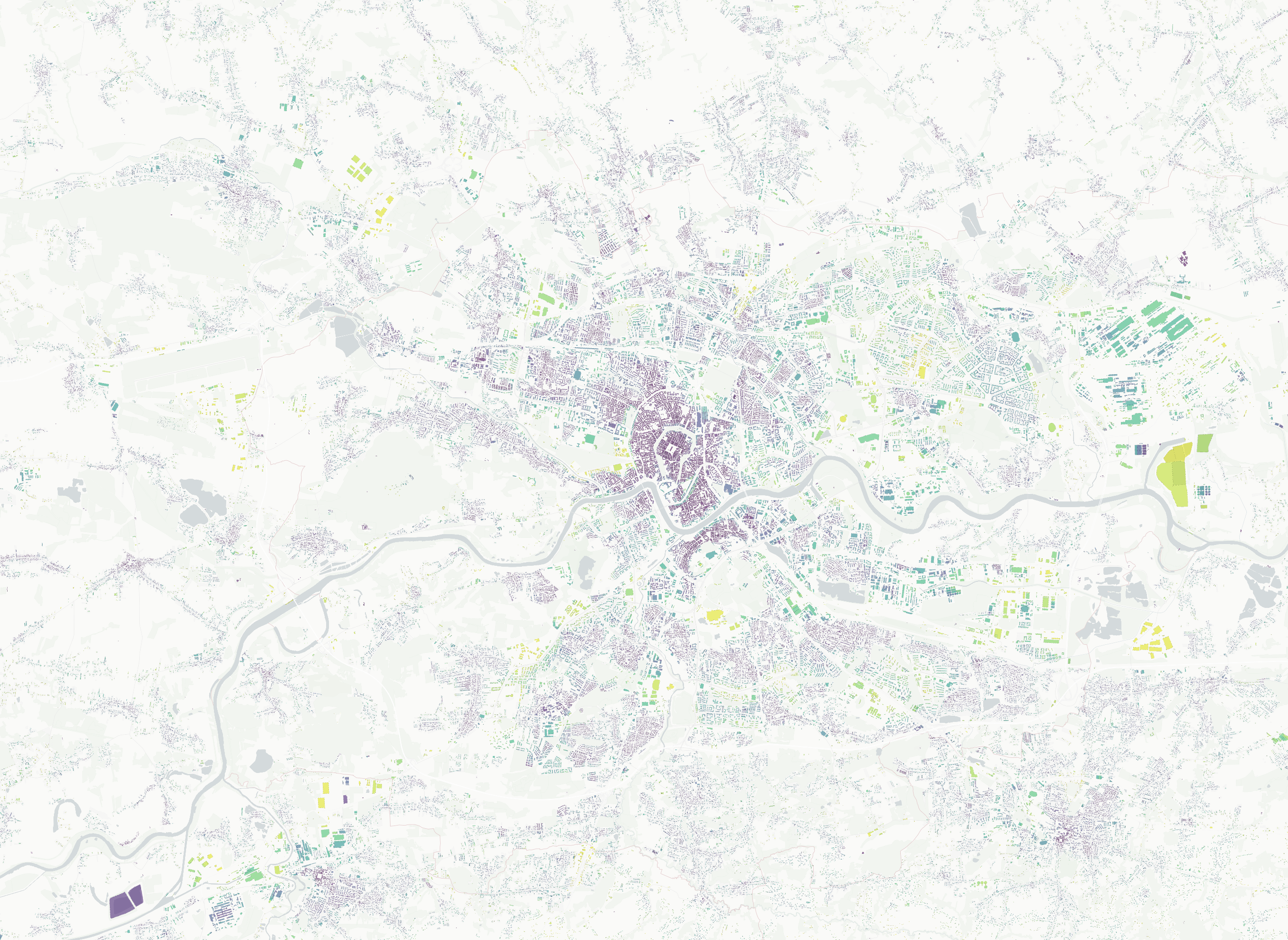
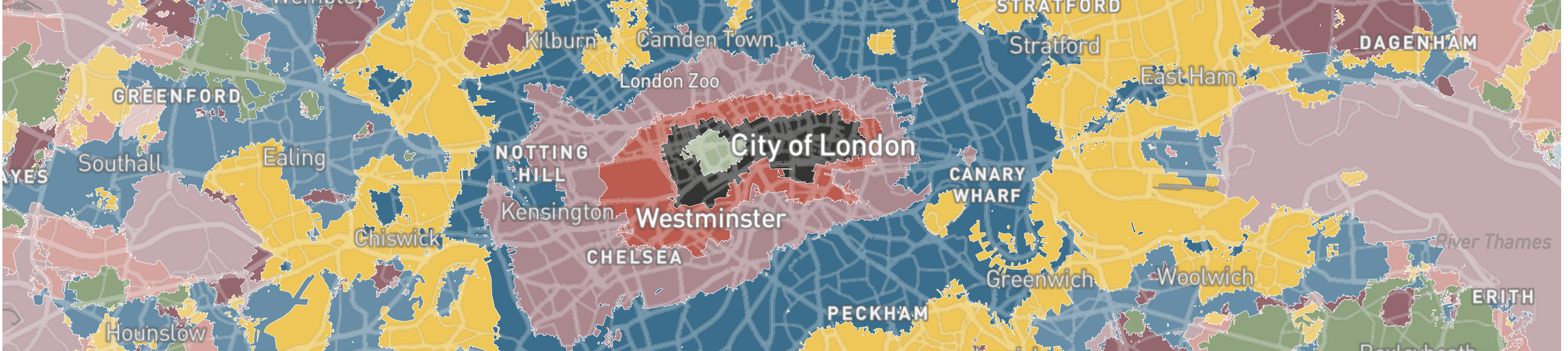
Temporal predictions
![]()
Outputs
Software and datasets
- Interactive morphometric web application
- Morphometric characterisation pipeline for Microsoft Building footprints
- Morphometric characterisation pipeline for Overture Maps Building footprints
- AI Method for Urban Fabric classification and morphometric characterization
- AI temporal data cube of Urban Fabric classifications
Stakeholder engagement
Major stakeholder engagements
- European Covenant of Mayors
- SSVA (Construction Sector Development Agency of the Ministry of Environment, Lithuania)
- Prague Institute of Planning and Development (IPR)
- 4ct
Influence on project
- Format of the final data product and its presentation method
- Inclusion of Construction Sector Development Agency of the Ministry of Environment, Lithuania (SSVA)
- Extending the morphometric pipeline to incorporate Overture Maps
- Strategic direction for the follow-up study
Takeaways
- Data Integration
- Taxonomy Description and Naming
- Comparative Urban Analysis
- Expanding Data Coverage
- Reducing Manual Effort in Land Use Analysis
- Geographical Scale of Results
- Taxonomic Tree & Evaluation
- Input data quality
Future work
The overarching strategy for scaling and productionalising the EuroFab system involves three principal phases.
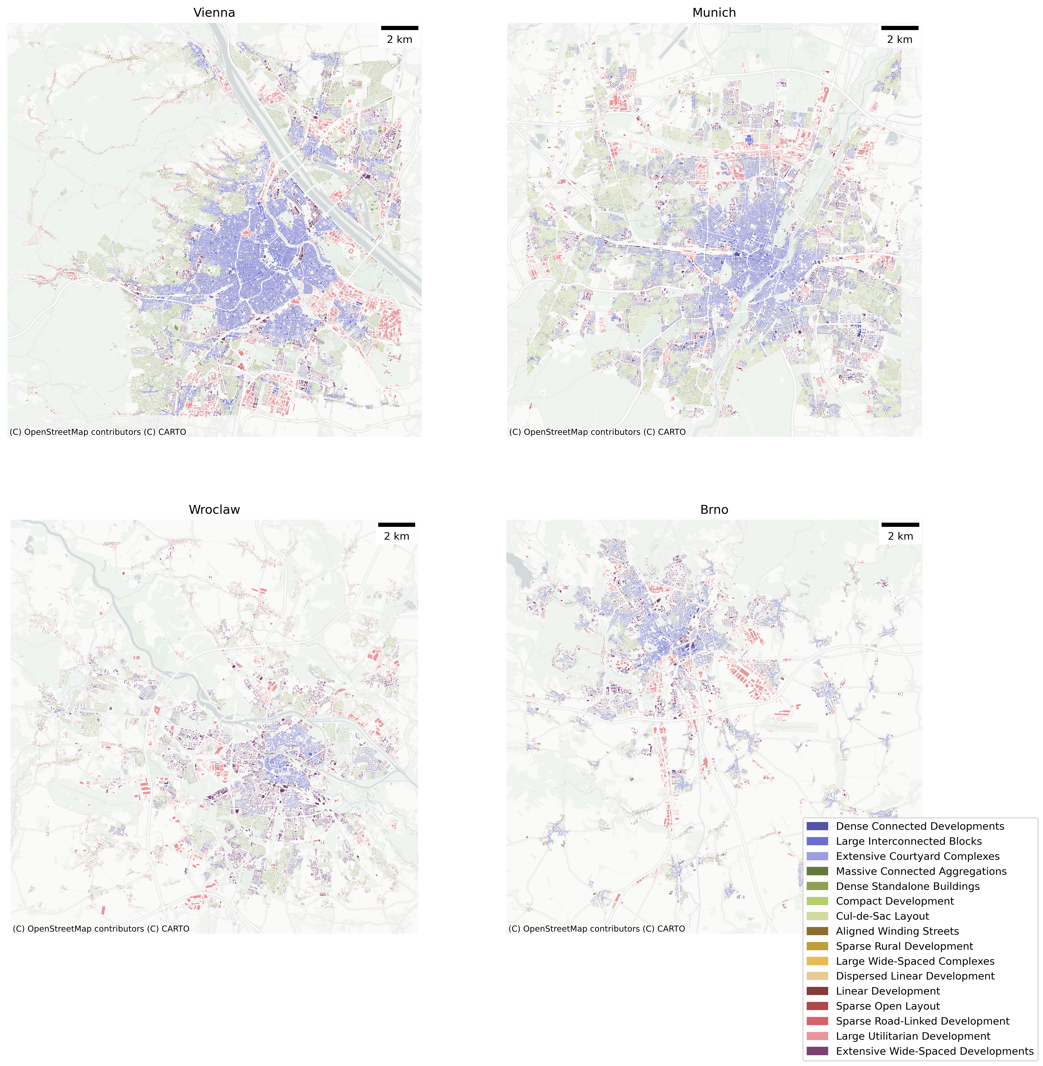
European classification of Urban Fabric
Using the morphometric pipeline to generate detailed urban classification at a pan-European scale.
Challenges & Strategy
Alignment with Cadastral Classification
Heterogenous data sources
Data Gaps
Unknown urban fabric types
Model Tuning and Optimisation
European classification of Urban Fabric across time (AI model)
Training the AI vision model on the outputs from step one, to fill data gaps and to produce a temporal classification based on historical satellite data.
Challenges & Strategy
Leveraging Copernicus Services
Leveraging the new morphometric classification results as ground truth
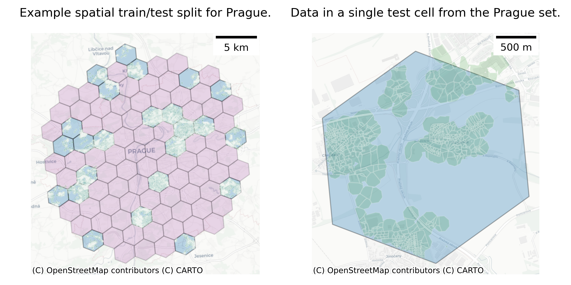
Generalisability Testing:
Evaluation of urban predictions across time
Methodological processing
Expanded Stakeholder engagement
Third, productising the refined classification results and expanding stakeholder engagement activities. This will be crucial for driving user adoption and facilitating the derivation of secondary indicators and specialised datasets tailored to specific applications, such as regional development analysis or climate change impact assessments.
Challenges & Strategy
Workshops and conference work
Closer Engagement with Specific Cities and Regions
Collaborations & co-development
Developing derived products
Supporting Third-Party Development of Derived Products
Discussion
![]()