EuroFab Progress Meeting
2024-04-04
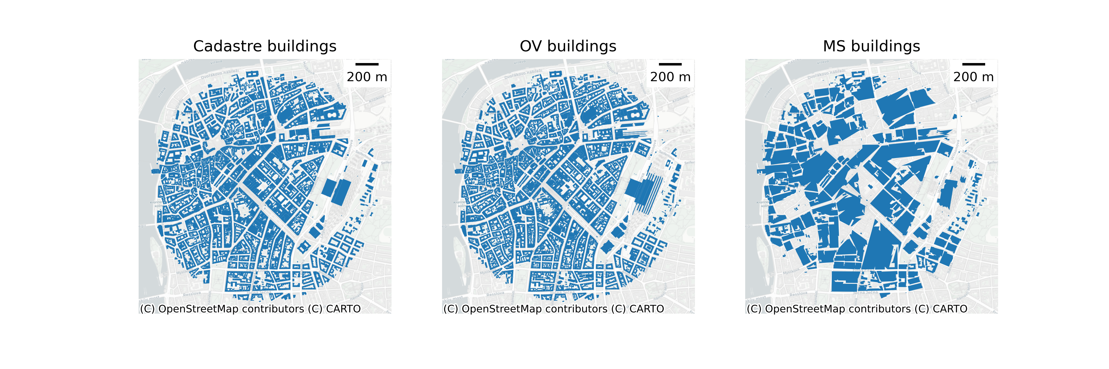
Morphometric model
Extensions & changes
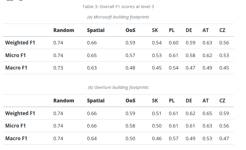
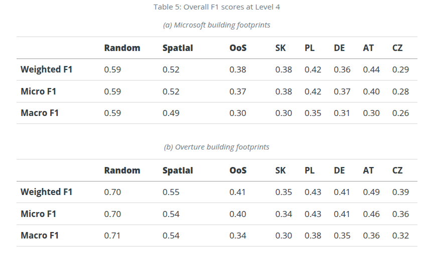
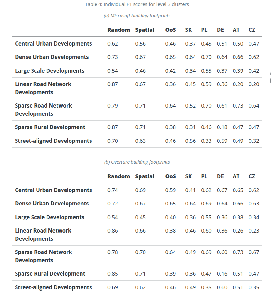
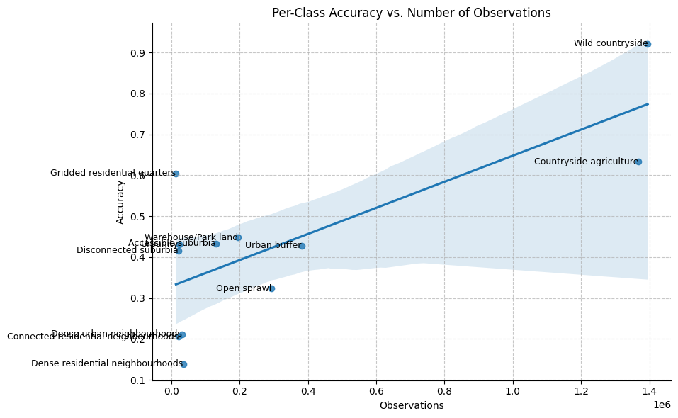
Agg scores
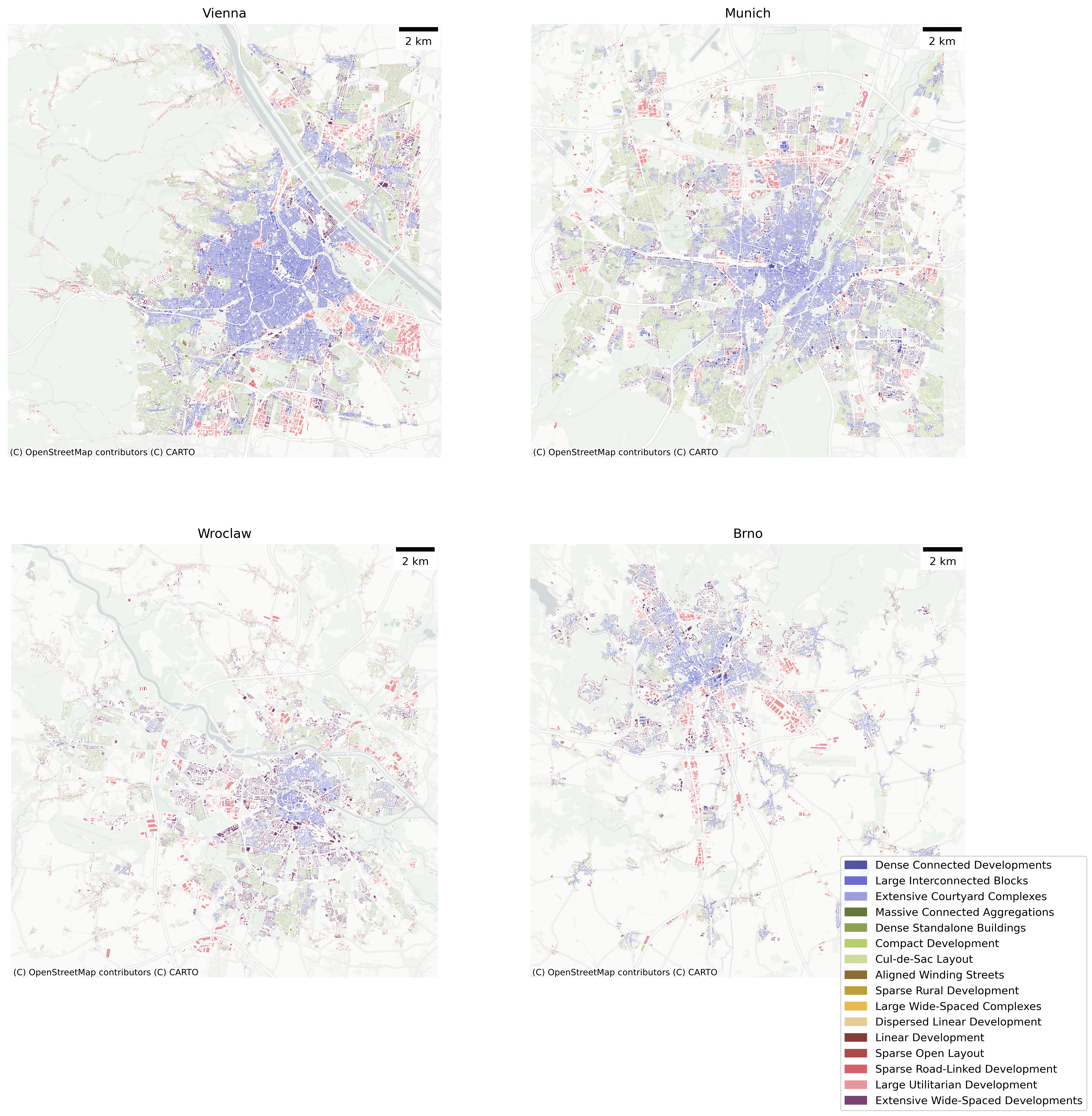
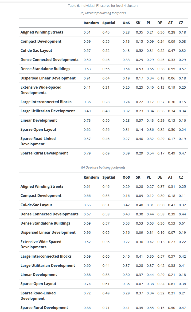
Class scores
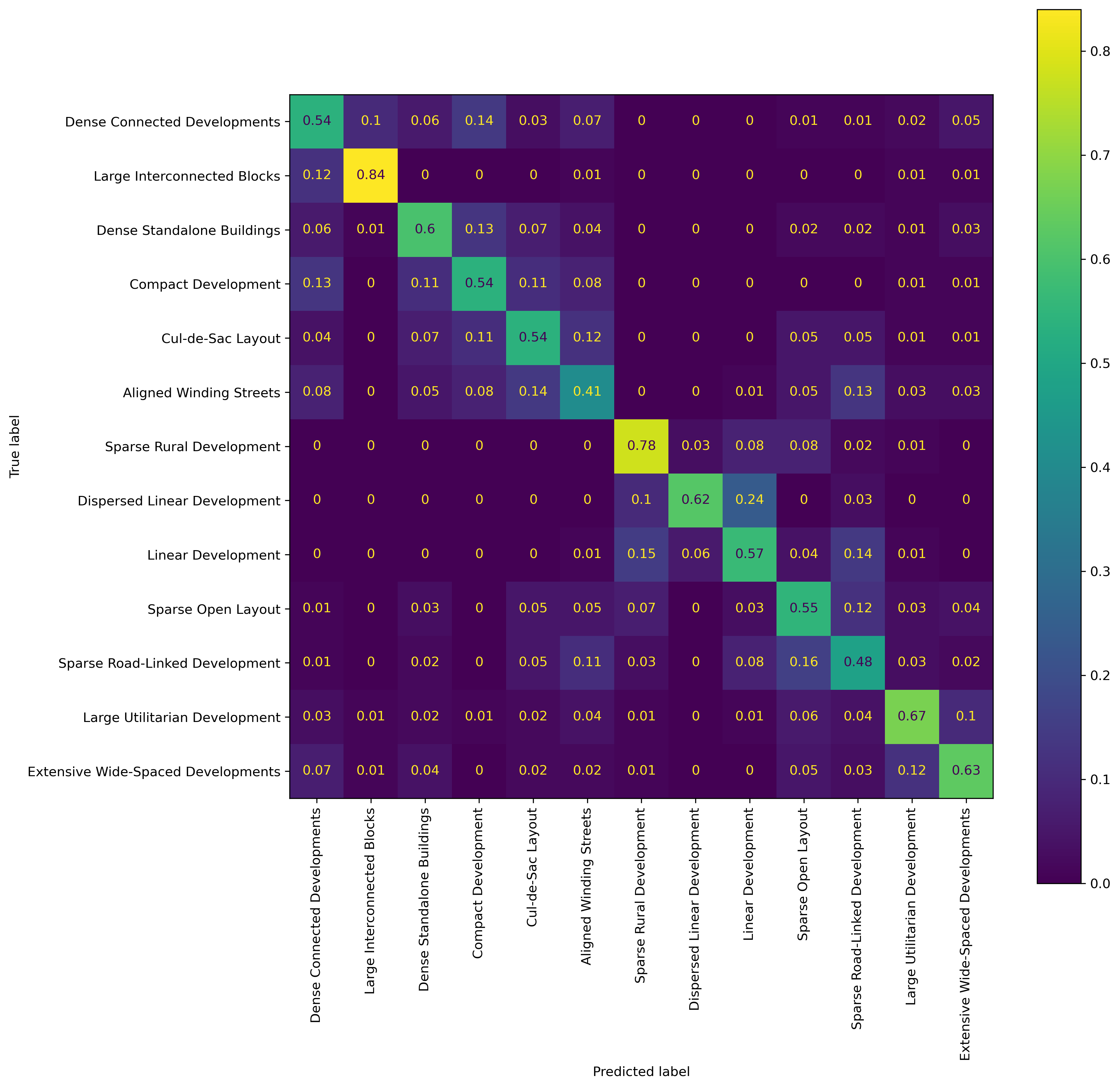
Confusion Matrix
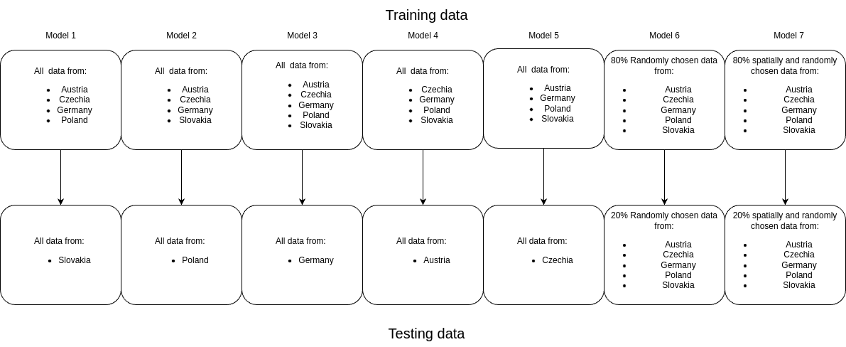
Data augmentation
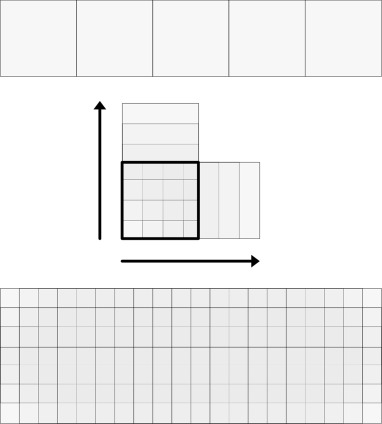
Sliding Window Augmentation (50m)
Data augmentation

Examples
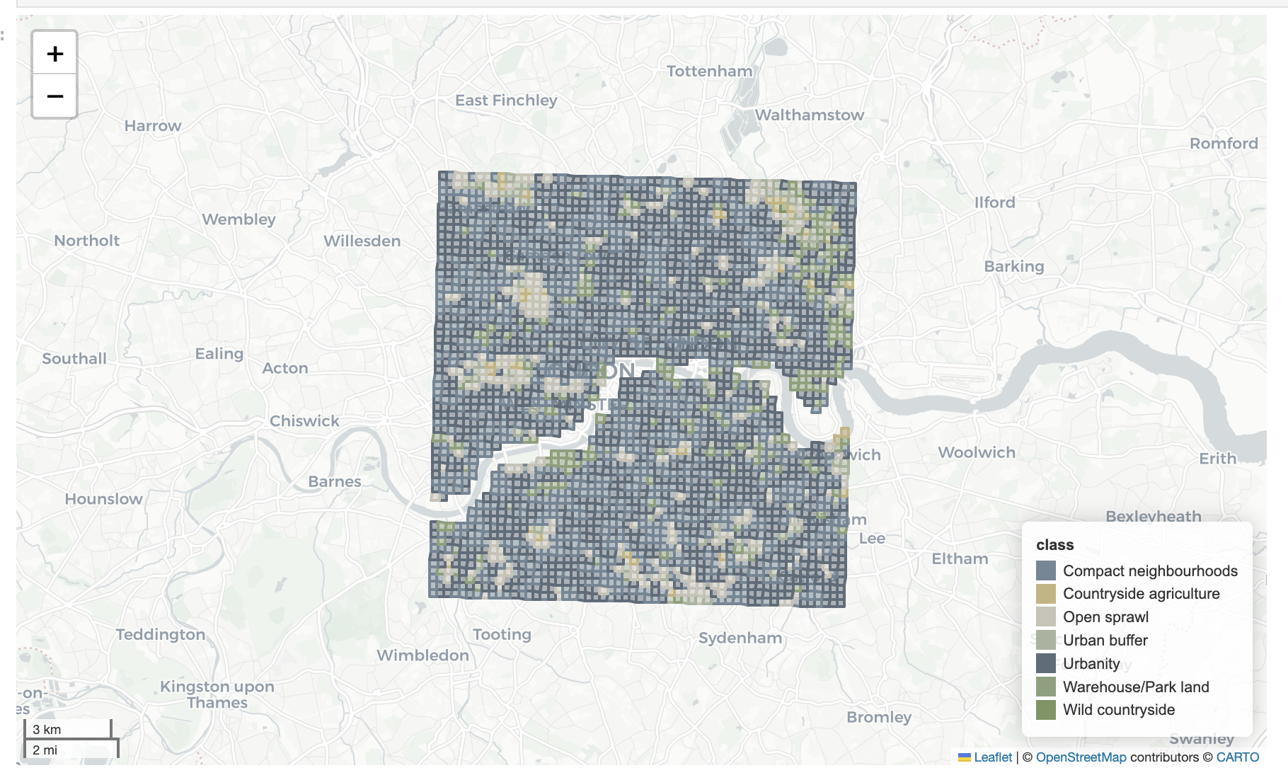
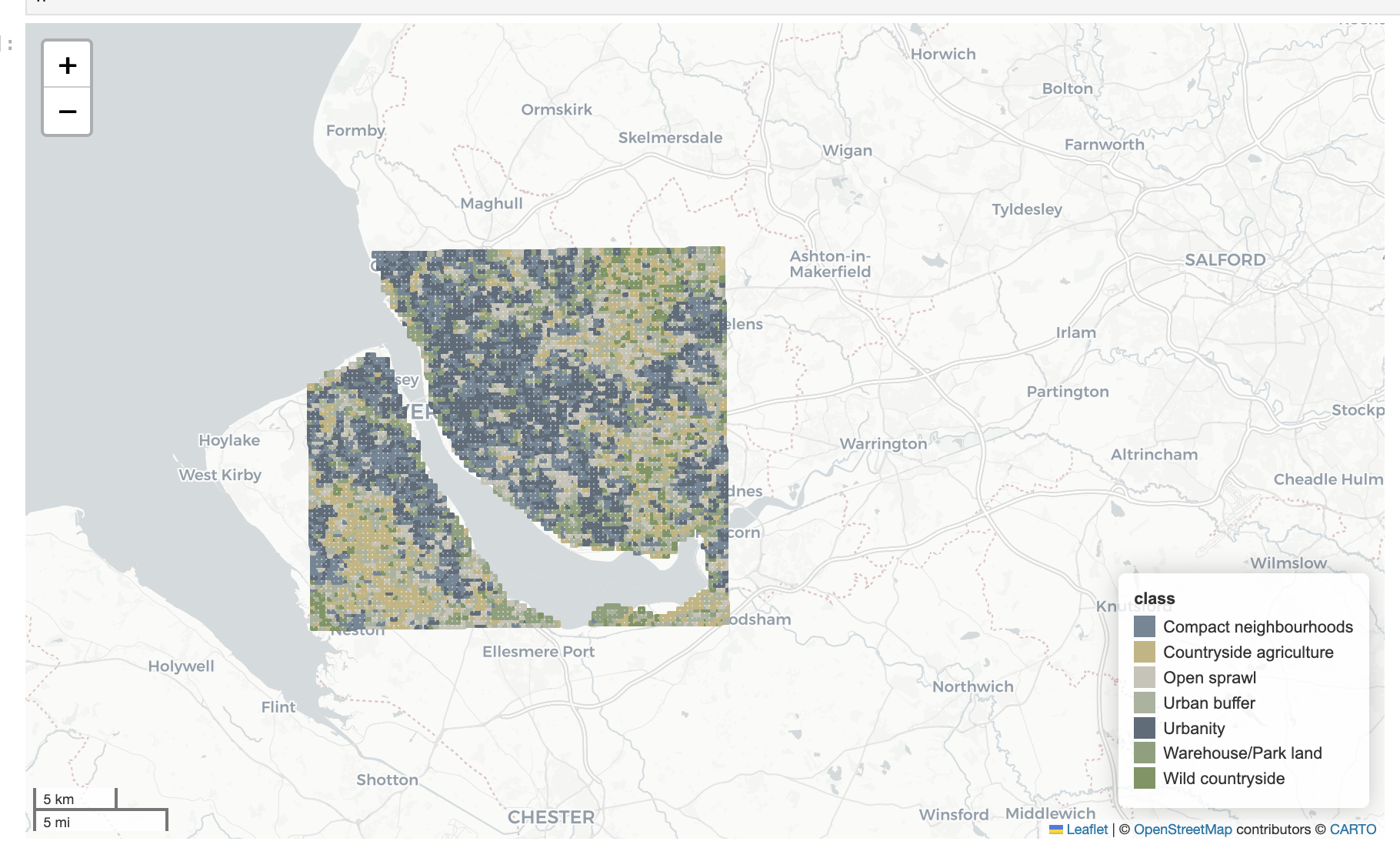
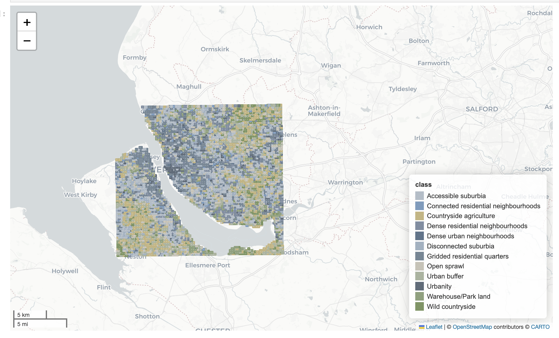
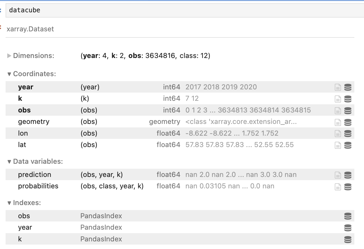
Datacube
- predictions for all of GB
- 2016-2021
- K=7 and K=12